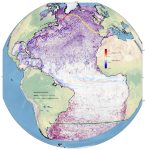
GIGATL: Atlantic Ocean with the terrain-following model CROCO
Horizontal resolutions 6 km / 3 km / 1 km with 100 topography following levels (refined at the bottom), tides, hourly atmospheric forcing, river outflows
Simulations available:
- GIGATL6 (many versions) = From 2004-01-01 to 2014-01-01 = 10 years
- GIGATL3 (no tides) = From 2004-01-01 to 2013-03-17
- GIGATL3 ( tides) = From 2007-03-25 to 2009-03-17
- GIGATL1 (no tides) = From 2007-07-12 to 2009-02-19
- GIGATL1 ( tides) = From 2007-07-02 to 2009-06-12

